
Understanding Helicopter Landing Locations in Nepal
An informational guide to verified helicopter landing locations and areas relevant to helicopter travel in Nepal.
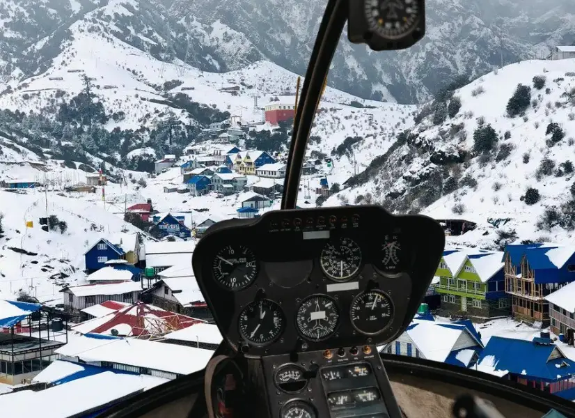
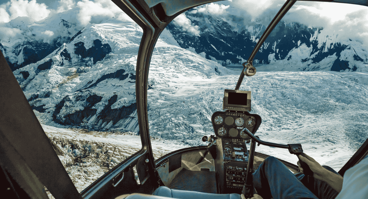
Nepal has a wide variety of helicopter landing locations, ranging from CAAN-certified airports and registered helipads to informal landing areas on ridgelines, cleared ground, and open fields. Understanding the differences between these location types is important for planning helicopter travel in Nepal.
Helicopter landing locations in Nepal are not all the same. The terms helipad, heliport, airport, landing area, and landing site are often used interchangeably, but they refer to different types of facilities with different levels of infrastructure, regulation, and certification.
Types of Helicopter Landing Locations
- Airports used by helicopters: CAAN-certified aerodromes with runways that accommodate both fixed-wing and helicopter operations. Examples include Lukla (Tenzing-Hillary Airport), Jomsom Airport, and Pokhara Airport.
- Heliports: Facilities specifically designed for helicopter operations. The Nalinchowk Heliport in Bhaktapur, opened in 2024, is an example of a CAAN-developed heliport in the Kathmandu Valley.
- Registered helipads: Helicopter landing areas that are listed in aviation databases with specific designators. Examples include Namche Bazaar (NP-0012), Tengboche (NP-0005), and Pathibhara Devi Temple (NP-0017).
- Rooftop helipads: Helicopter landing areas built on building rooftops, commonly found at hospitals and hotels. These require specific structural and safety standards.
- Landing areas: Informal or designated landing zones that are not officially certified as helipads. Many popular helicopter destinations in Nepal, including Annapurna Base Camp, Kyanjin Gompa, and Muktinath, fall into this category.
- Temporary or seasonal landing areas: Landing zones that may be used only during certain seasons or under specific conditions, such as high-altitude areas that are accessible only when weather permits.
How Helicopter Landing Locations Are Regulated
Helicopter operations in Nepal are regulated by the Civil Aviation Authority of Nepal (CAAN), which oversees aerodrome safety, certification, and aviation requirements. However, CAAN's regulatory role differs depending on the type of landing location.
CAAN's Role in Aerodrome Oversight
- Certified aerodromes: CAAN inspects, certifies, and maintains safety standards for certified airports such as Tribhuvan International Airport, Lukla, and Jomsom.
- Registered helipads: CAAN maintains records of registered helipads through its Aeronautical Information Publication (AIP) and aerodrome databases.
- Unregistered landing areas: CAAN does not operate, maintain, or provide security for landing areas on government and private property. Operators are required to obtain necessary information before conducting flights to these locations.
- Permissions: Helicopter operations may require permissions from CAAN, national park authorities, local municipalities, or property owners depending on the location.
- Operator responsibility: Helicopter operators are responsible for conducting their own risk assessments, obtaining current information about landing conditions, and ensuring compliance with applicable aviation requirements.
Kathmandu Valley Helicopter Landing Locations
The Kathmandu Valley serves as the primary departure hub for helicopter operations across Nepal. The valley has several helicopter landing facilities, including the country's main international airport, a dedicated heliport, and various private and hospital helipads.
Airport Facilities
Tribhuvan International Airport (KTM) is Nepal's primary international airport at 1,340 meters (4,395 feet) elevation. It has 13 helicopter parking stands at the domestic apron. Since June 2024, commercial helicopter operations have largely shifted to the Nalinchowk Heliport, with TIA now primarily used for emergency helicopter operations.
Dedicated Helicopter Facilities
Nalinchowk Heliport in Bhaktapur, opened in June 2024, is a CAAN-developed heliport at approximately 1,400 meters (4,593 feet) elevation. It has 13 parking stands and 4 simultaneous takeoff and landing pads. CAAN mandated that each helicopter company park at least one aircraft at this facility.
Other Landing Areas
The Kathmandu Valley also has various rooftop helipads at hospitals, hotels, and private buildings. These are typically used for specific operational purposes and are not public helicopter landing facilities. Helicopter operators based in the Kathmandu Valley include Air Dynasty, Manang Air, Prabhu Helicopter, Simrik Air, Shree Airlines, and Fishtail Air.
Everest Region Helicopter Landing Locations
The Everest (Khumbu) region has Nepal's most heavily used helicopter landing locations, with operations centered around Lukla as the primary gateway. This region has seen significant regulatory activity in recent years, including disputes over commercial helicopter operations and safety directives following incidents.
Lukla / Tenzing-Hillary Airport
Lukla (2,860m / 9,383ft) is a CAAN-certified domestic airport and the primary helicopter gateway to the Everest region. It handles extremely heavy helicopter traffic, with over 150 helicopter operations recorded on peak days. The airport is the starting point for most Everest helicopter tours and serves as a refueling stop for flights heading to higher-altitude locations.
Namche / Syangboche Area
Syangboche Airport (3,748m / 12,293ft) is listed by CAAN but is not authorized for commercial fixed-wing operations. However, helicopter landings at Syangboche remain common for chartered flights, tourist scenic flights, and evacuations. The Namche Bazaar helipad (registered as NP-0012) at approximately 3,440 meters is an active helicopter landing area used for supply runs, tourist flights, and medical evacuations. The Hotel Everest View at Syangboche (3,880m) is a frequent stop on Everest helicopter tours for breakfast and panoramic views.
Tengboche
Tengboche (approximately 3,860m / 12,664ft) is a registered helipad (NP-0005) that is active for helicopter operations. It is commonly used as a stop on Everest helicopter tours and provides views of Ama Dablam, Everest, and the surrounding peaks.
Pheriche
Pheriche (approximately 4,371m / 14,340ft) is a registered helipad (NP-0008) that serves as a primary rescue staging area in the Everest region. It is also used as a shuttle stop during helicopter tours to manage weight for high-altitude flights to upper viewpoints.
Dingboche and Lobuche
Dingboche (approximately 4,410m) and Lobuche (approximately 4,940m) are landing areas used for rescue operations and some tourist helicopter flights. These locations are not formally certified helipads. Following the October 2025 Altitude Air helicopter crash at Lobuche, CAAN issued Circular 12/2025 mandating stricter safety measures for high-altitude winter operations, including requirements for bear paws on skids, mandatory marshalling, and snow/ice clearance at helipads.
Gorak Shep and Kala Patthar
Gorak Shep (approximately 5,164m) is an active landing area used for rescue and charter helicopter operations. Kala Patthar (approximately 5,545m) was historically the standard landing viewpoint for Everest helicopter tours, providing the closest panoramic view of Mount Everest. However, helicopter landings at Kala Patthar may be subject to current restrictions following CAAN's safety directives issued after the October 2025 Lobuche incident.
Everest Base Camp
Annapurna Region Helicopter Landing Locations
The Annapurna region is accessed primarily through Pokhara, which has two airports serving helicopter operations. The region includes several verified helicopter landing areas, with Annapurna Base Camp being the most popular destination.
Pokhara Airports
Pokhara Airport (Old) (1,438m / 4,718ft) is a CAAN-certified domestic airport that continues to serve helicopter operations to the Annapurna region, Mustang, and Muktinath. Pokhara International Airport (approximately 827m / 2,713ft), opened in January 2023, has become a major hub for helicopter operations to western Nepal, with several operators establishing bases there.
Annapurna Base Camp
Annapurna Base Camp (approximately 4,130m / 13,549ft) is an active helicopter landing zone inside the Annapurna Sanctuary. As of 2025, helicopter operations to ABC are regulated by the Annapurna Rural Municipality, which has imposed a landing fee of Rs. 10,000 per flight, a daily limit of 12 flights, and a requirement for helicopter companies to register with the municipality. Rescue flights are exempt from landing fees. An ACAP (Annapurna Conservation Area Project) permit is also required.
Langtang Region Helicopter Landing Locations
The Langtang region lies north of Kathmandu and is one of the more accessible helicopter tour destinations from the capital. The region has several landing areas used for helicopter tours and pilgrimage flights.
Langtang Valley / Kyanjin Gompa
Kyanjin Gompa (approximately 3,870m / 12,697ft) is an active helicopter landing zone and a popular destination for helicopter tours from Kathmandu, typically a 30-minute flight. Helicopters land on flat open ground near the monastery. This is a landing area rather than a formally constructed helipad. Note that CAAN lists a separate "Langtang Airport" (VNLT) as not in operation; this is a different, lower-altitude location near Langtang village, not Kyanjin Gompa.
Gosaikunda
Gosaikunda Lake (approximately 4,380m / 14,370ft) is an active helicopter landing zone used for pilgrimage helicopter tours from Kathmandu, typically a 25 to 30-minute flight. The landing area is a flat gravel area approximately 200 meters from the lakeshore. Located within Langtang National Park, a park entry permit is required. Ground time at altitude is typically limited to 15 to 45 minutes.
Mustang Region Helicopter Landing Locations
The Mustang region in western Nepal offers some of the most dramatic helicopter landing locations in the country, including the gateway to the restricted Upper Mustang area.
Jomsom Airport
Jomsom Airport (2,736m / 8,976ft) is a CAAN-certified domestic airport and a major helicopter hub for the Mustang region. While STOL (Short Takeoff and Landing) fixed-wing flights operate seasonally on the Pokhara-Jomsom route, helicopter services operate year-round. The airport has capacity for 4 fixed-wing and 2 helicopter parking positions.
Muktinath
Muktinath (approximately 3,710 to 3,800m) is an active helicopter landing zone at Ranipauwa, approximately 10 to 15 minutes uphill walk from the Muktinath Temple. Horse and motorbike services are available from the landing area to the temple. Muktinath helicopter tours operate from both Pokhara and Kathmandu.
Kagbeni and Upper Mustang
Kagbeni (approximately 2,810m) is a landing area used as a refueling stop on some Mustang helicopter tour itineraries. Upper Mustang / Lo Manthang (approximately 3,800m) is an active helicopter landing zone in the restricted area. Upper Mustang requires a Restricted Area Permit (approximately $500 per person), an ACAP permit, and a Restricted Area Helicopter Landing Permit. Tours must be booked in advance through a registered trekking company.
Pilgrimage Helicopter Landing Locations
Several helicopter landing locations in Nepal are associated with important pilgrimage destinations, making helicopter travel a practical option for religious visits.
Muktinath
Muktinath Temple is one of Nepal's most sacred pilgrimage sites for both Hindus and Buddhists. Helicopter tours to Muktinath depart from Pokhara (45 to 55 minutes) and Kathmandu (1 hour 15 minutes to 1 hour 30 minutes). The helicopter landing zone at Ranipauwa provides access to the temple complex, which features 108 water spouts and an eternal flame.
Gosaikunda
Gosaikunda Lake holds deep significance in Hindu and Buddhist traditions. Helicopter tours from Kathmandu bring pilgrims to this sacred alpine lake in under two hours. The flight crosses dramatic ridgelines with views of Manaslu and Ganesh Himal. Gosaikunda is especially popular during the Janai Purnima festival.
Pathibhara Devi Temple
Pathibhara Devi Temple in eastern Nepal has a registered helipad (NP-0017) at approximately 3,779 meters. Regular helicopter pilgrimage flights operate from Kathmandu, Biratnagar, Dharan, and Bhadrapur. From the helipad, pilgrims walk approximately 10 to 15 minutes uphill to the temple.
Halesi Mahadev
Halesi Mahadev in eastern Nepal is a cave temple complex with a landing area accessible by charter helicopter from Kathmandu. Helicopter charters are available with various aircraft sizes, though no regular scheduled helicopter service operates to this location.
Remote & High-Altitude Helicopter Landing Areas
Beyond the major tourist and pilgrimage destinations, Nepal has numerous remote and high-altitude helicopter landing areas used for rescue operations, expedition support, supply runs, and occasional tourist flights.
Trekking Areas and Mountain Villages
Helicopter landing areas exist at various trekking locations throughout Nepal, including Pangboche (approximately 3,985m), Chukung (approximately 4,730m), Gokyo (approximately 4,790m), and Thame (approximately 3,800m). These locations are primarily used for rescue operations and expedition support rather than regular tourist helicopter services.
Base Camp Areas
Base camp areas for major mountain expeditions serve as helicopter landing zones for rescue and resupply operations. These landing areas are typically informal, seasonally active, and subject to operational conditions including weather, terrain, and aircraft performance.
Rescue and Medical Landing Areas
Rescue helicopter operations use a network of landing areas across Nepal, including locations at Manang (approximately 3,519m), Pheriche, and various high-altitude points. These operations are essential for medical evacuation and emergency response in mountainous terrain.
Helipad & Landing Location Information Table
The following table provides a summary of verified helicopter landing locations in Nepal. This is an informational guide and should not be considered a definitive official registry. Operational status and availability can change.
| Location | Region | Type | Elevation | Status | Typical Use | Source |
|---|---|---|---|---|---|---|
| Tribhuvan Intl Airport (KTM) | Kathmandu | CAAN Intl Airport | 1,340m | Active | Helicopter hub; heli ops moved to Nalinchowk | CAAN |
| Nalinchowk Heliport | Kathmandu | CAAN Heliport | ~1,400m | Active | Commercial helicopter operations base | CAAN |
| Lukla (Tenzing-Hillary) | Everest / Khumbu | CAAN Domestic Airport | 2,860m | Active | Primary Everest region helicopter gateway | CAAN |
| Syangboche | Everest / Khumbu | CAAN Airport (Not in operation for fixed-wing) | 3,748m | Helicopters land informally | Chartered flights, tourist flights, evacuations | CAAN / Wikipedia |
| Namche Bazaar | Everest / Khumbu | Registered Helipad (NP-0012) | ~3,440m | Active | Supply runs, tourist flights, evacuations | AirportMap / AirportGuide |
| Tengboche | Everest / Khumbu | Registered Helipad (NP-0005) | ~3,860m | Active | Tourist helicopter tours | AirportGuide / AirportMap |
| Pheriche | Everest / Khumbu | Registered Helipad (NP-0008) | ~4,371m | Active | Rescue staging, shuttle stop for tours | AirportGuide / Bigorre |
| Dingboche | Everest / Khumbu | Landing Area | ~4,410m | Conditional | Rescue, tourist flights | Himalayan Times |
| Lobuche | Everest / Khumbu | Landing Area | ~4,940m | Stricter rules post-Oct 2025 | Rescue, tourist flights | CAAN Investigation Report |
| Gorak Shep | Everest / Khumbu | Landing Area | ~5,164m | Conditional | Rescue, charter flights | Multiple operators |
| Kala Patthar | Everest / Khumbu | Landing Zone | ~5,545m | Restrictions in effect | Scenic viewpoint (restrictions may apply) | CAAN Circular 12/2025 |
| Everest Base Camp | Everest / Khumbu | Landing Area (Glacial) | ~5,364m | Landing prohibited since 2021 | Overflight only | CAAN |
| Pokhara Airport (Old) | Annapurna | CAAN Domestic Airport | 1,438m | Active | Heli ops to Annapurna, Mustang, Muktinath | CAAN |
| Pokhara International Airport | Annapurna | CAAN Intl Airport | ~827m | Active | Major heli hub for western Nepal | CAAN |
| Annapurna Base Camp | Annapurna | Landing Area | ~4,130m | Active; 12 flights/day limit | Tourist helicopter tours | Tourism Info Nepal |
| Kyanjin Gompa (Langtang) | Langtang | Landing Area | ~3,870m | Conditional | Popular heli tour destination | Multiple operators |
| Gosaikunda Lake | Langtang | Landing Area | ~4,380m | Conditional | Pilgrimage helicopter tours | Multiple operators |
| Jomsom Airport | Mustang | CAAN Domestic Airport | 2,736m | Active (heli year-round) | Mustang region helicopter hub | CAAN |
| Muktinath (Ranipauwa) | Mustang | Landing Area | ~3,710-3,800m | Conditional | Pilgrimage helicopter tours | Multiple operators |
| Kagbeni | Mustang | Landing Area | ~2,810m | Conditional | Refueling stop for Mustang tours | Multiple operators |
| Upper Mustang / Lo Manthang | Mustang | Landing Area (Restricted) | ~3,800m | Active; RAP required | Restricted area helicopter tours | Multiple operators |
| Pathibhara Devi Temple | Eastern Nepal | Registered Helipad (NP-0017) | ~3,779m | Active | Pilgrimage flights | AirportGuide / Bigorre |
| Halesi Mahadev | Eastern Nepal | Landing Area | ~1,000-1,460m | Charter only | Charter helicopter pilgrimage | Multiple operators |
| Manang | Annapurna | Airport Not In Operation; Helipad exists | ~3,519m | Conditional | Annapurna Circuit helicopter access | CAAN / LuklaHelicopter |
How Helicopter Landing Locations Are Selected
The selection of a helicopter landing location depends on multiple factors that are assessed by the pilot and operator before each flight. These factors determine whether a specific location can be safely used for landing.
- Terrain: The landing area must have suitable ground conditions, including flat or near-flat terrain free from large obstacles.
- Elevation: Higher elevation affects aircraft performance, payload capacity, and engine power. This is why helicopters often shuttle passengers at high-altitude locations like Pheriche.
- Weather: Visibility, wind speed, cloud base, temperature, and precipitation all affect whether landing is possible at a given location.
- Wind conditions: Strong or gusty winds, wind shear, and turbulence near ridgelines can make landing unsafe at exposed locations.
- Obstacles: Trees, buildings, power lines, rock formations, and other obstacles in the approach and departure paths affect landing feasibility.
- Aircraft performance: The helicopter's weight, fuel load, passenger count, and payload affect how it performs at different elevations and temperatures.
- Pilot assessment: The pilot makes the final decision on whether to land based on all available information, visual assessment, and operational judgment.
- Operator procedures: Each helicopter operator has standard operating procedures for assessing and using landing locations, including risk assessment protocols.
- Aviation requirements: CAAN regulations, Visual Flight Rules (VFR), and any applicable permissions or restrictions govern landing operations.
- Permissions: Some locations require specific permissions from authorities, park offices, local municipalities, or property owners.
Can Helicopters Land Anywhere in Nepal?
No. Helicopters cannot land anywhere in Nepal. Helicopter landing is subject to operational, safety, regulatory, and site-specific requirements.
While Nepal has a wide variety of helicopter landing locations, each location must meet certain criteria for safe helicopter operations. The pilot and operator assess multiple factors before any landing, including terrain, weather, aircraft performance, obstacles, and applicable regulations.
- Not every flat area is suitable for helicopter landing
- High-altitude locations have reduced aircraft performance and payload limitations
- National park and conservation area landings may require specific permissions
- Some areas are restricted or prohibited for helicopter operations
- Weather conditions may prevent landing at otherwise suitable locations
- Private property landings require owner permission
- Emergency and rescue operations may have different operational considerations
CAAN's Aeronautical Information Publication makes clear that CAAN does not operate heliports and does not maintain landing areas on government and private property. Operators must obtain necessary information and ensure compliance with all applicable requirements before conducting flights to any location.
Helipad Information for Popular Go Heli Tours
The following popular helicopter tours offered by Go Heli Services include various landing locations and flight routes across Nepal. Landing points may vary based on weather, operational conditions, and pilot assessment.
Everest Base Camp Helicopter Tour
Typical flight locations may include Lukla, Pheriche, Kala Patthar viewpoint, and Hotel Everest View at Syangboche. Everest Base Camp is overflown but landing is prohibited.
Luxury Everest Helicopter Tour
Typical flight locations may include Lukla, Kala Patthar viewpoint, and Hotel Everest View for breakfast with Himalayan panoramas.
Annapurna Base Camp Helicopter Tour
Typical flight locations may include Pokhara departure and Annapurna Base Camp landing area inside the Annapurna Sanctuary.
Langtang Valley Helicopter Tour
Typical flight locations may include Kathmandu departure and Kyanjin Gompa landing area in the Langtang Valley.
Gosaikunda Helicopter Tour
Typical flight locations may include Kathmandu departure and the Gosaikunda Lake landing area near the sacred alpine lake.
Muktinath Helicopter Tour
Typical flight locations may include Pokhara or Kathmandu departure and the Muktinath landing area at Ranipauwa near the temple.
Kathmandu to Lukla Helicopter Flight
Direct helicopter transfer from Kathmandu to Lukla, with landing at Tenzing-Hillary Airport.
Planning a Helicopter Flight From a Landing Location
When planning a helicopter flight to or from any landing location in Nepal, several practical considerations help ensure a smooth travel experience.
- Departure point: Know your departure airport or heliport. Most helicopter flights from Kathmandu depart from Tribhuvan International Airport domestic section or Nalinchowk Heliport. Pokhara flights depart from Pokhara Airport or Pokhara International Airport.
- Meeting point and timing: Helicopter operators typically designate a meeting point and check-in time. Arrive early for safety briefings and weight checks.
- Destination confirmation: Confirm the specific landing location with your helicopter operator before travel, as landing points may change based on conditions.
- Weather awareness: Mountain weather can change quickly. Be prepared for possible delays or rescheduling due to weather conditions.
- Passenger details: Provide accurate passenger information including weights, as weight and balance are critical for high-altitude helicopter operations.
- Baggage and weight considerations: Helicopter payload is limited, especially at high altitudes. Check baggage allowances with your operator.
- Landing restrictions: Some locations have specific landing restrictions, time limits, or permit requirements. Your operator will advise on applicable restrictions.
- Operational changes: Landing locations, flight routes, and schedules may change at short notice due to operational conditions. Stay in contact with your operator.
Disclaimer
Landing locations, operational status, permissions, and accessibility can change. Helicopter operations remain subject to weather, terrain, aircraft capability, pilot/operator assessment, applicable aviation requirements, and permissions where required. Always confirm the current landing location with the helicopter operator before travel. This page is an informational guide to verified helicopter landing locations and areas relevant to helicopter travel in Nepal. It is not a definitive official registry of every helipad in Nepal. Information is based on CAAN sources, aviation databases, and reputable travel and aviation publications as of August 2026. Go Heli Services does not own or operate any helipad or helicopter.
Nepal Helipad Guide FAQs
What is a helipad?
A helipad is a landing area specifically designed or designated for helicopter operations. In Nepal, helipads range from formally constructed pads at hospitals and hotels to cleared areas at high-altitude trekking locations.
Where do helicopters land in Nepal?
Helicopters in Nepal land at CAAN-certified airports, registered helipads, and various landing areas across regions including Everest, Annapurna, Langtang, Mustang, and pilgrimage destinations. Many popular helicopter landing locations are informal landing areas rather than officially certified helipads.
Can helicopters land at Everest Base Camp?
Helicopter landings at Everest Base Camp have been prohibited since 2021 due to environmental and expedition disruption concerns. Helicopter tours to the Everest region typically fly over EBC and land at Kala Patthar or nearby viewpoints, though landing availability at Kala Patthar may also be subject to current restrictions.
Can helicopters land at Muktinath?
Yes. Helicopters can land at the Muktinath area, typically at a landing zone near Ranipauwa. From there, pilgrims walk approximately 10 to 15 minutes uphill to the Muktinath Temple. Horse and motorbike services are also available from the landing area.
Is Lukla a helicopter landing destination?
Yes. Lukla's Tenzing-Hillary Airport is a CAAN-certified domestic airport and the primary helicopter gateway to the Everest region. It handles extremely heavy helicopter traffic, especially during trekking seasons.
Can helicopters land at high-altitude trekking areas?
Helicopters can land at some high-altitude trekking areas such as Pheriche, Gorak Shep, Lobuche, and Annapurna Base Camp, but landing availability depends on weather, terrain, aircraft performance, pilot assessment, and applicable aviation requirements. Not all trekking locations have suitable landing areas.
Can helicopters land anywhere in Nepal?
No. Helicopter landing in Nepal is subject to operational, safety, regulatory, and site-specific requirements. CAAN does not operate heliports and does not maintain or provide security for landing areas on government and private property. Operators must obtain necessary information and permissions before conducting flights.
Do weather conditions affect helicopter landing?
Yes. Weather conditions, including visibility, wind, cloud cover, snow, and temperature, significantly affect helicopter landing operations. High-altitude and mountain landing areas are particularly sensitive to weather changes.
Can helicopter landing locations change?
Yes. Helicopter landing locations and their operational status can change due to weather, terrain conditions, regulatory decisions, safety directives, seasonal factors, or operator assessments. Always confirm the current landing location with the helicopter operator before travel.
Are all helicopter landing areas permanent helipads?
No. Many helicopter landing areas in Nepal are temporary, seasonal, or informal landing zones rather than permanent constructed helipads. Some are cleared ground areas, ridgelines, or open fields used for helicopter operations.
Do helicopters need permission to land in some locations?
Yes. Depending on the location, helicopter operations may require permissions from CAAN, national park authorities, local municipalities, or property owners. Restricted areas such as Upper Mustang require additional permits including Restricted Area Permits.
Can private helicopter charters use these landing locations?
Private helicopter charters can use many of the same landing locations as scheduled helicopter services, subject to the same operational requirements, weather conditions, permissions, and pilot assessment. Contact the helicopter operator for specific charter availability.